Project footprint released for Caloundra upgrade
The project footprint for the congestion-busting Caloundra Transport Corridor Upgrade (CTCU) has been confirmed.

The project footprint for the congestion-busting Caloundra Transport Corridor Upgrade (CTCU) has been confirmed.
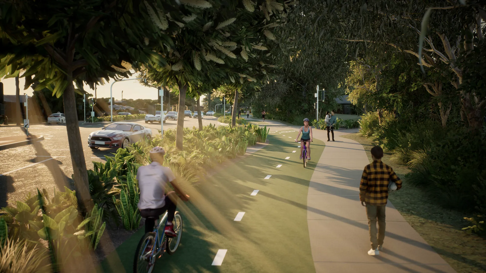
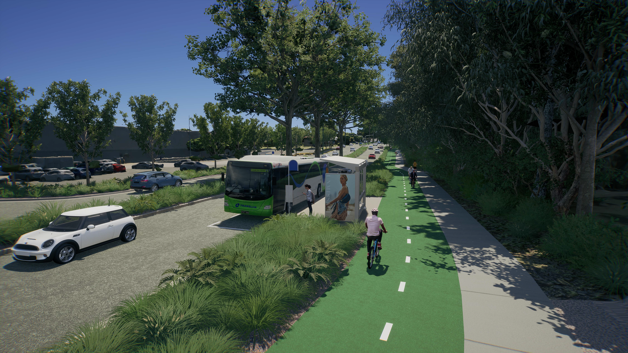
The 1.6 kilometre corridor is an essential route to improve connectivity and travel choice into the Caloundra Central Business District and encourages active and sustainable transport, including walking, cycling, electric vehicles and public transport.
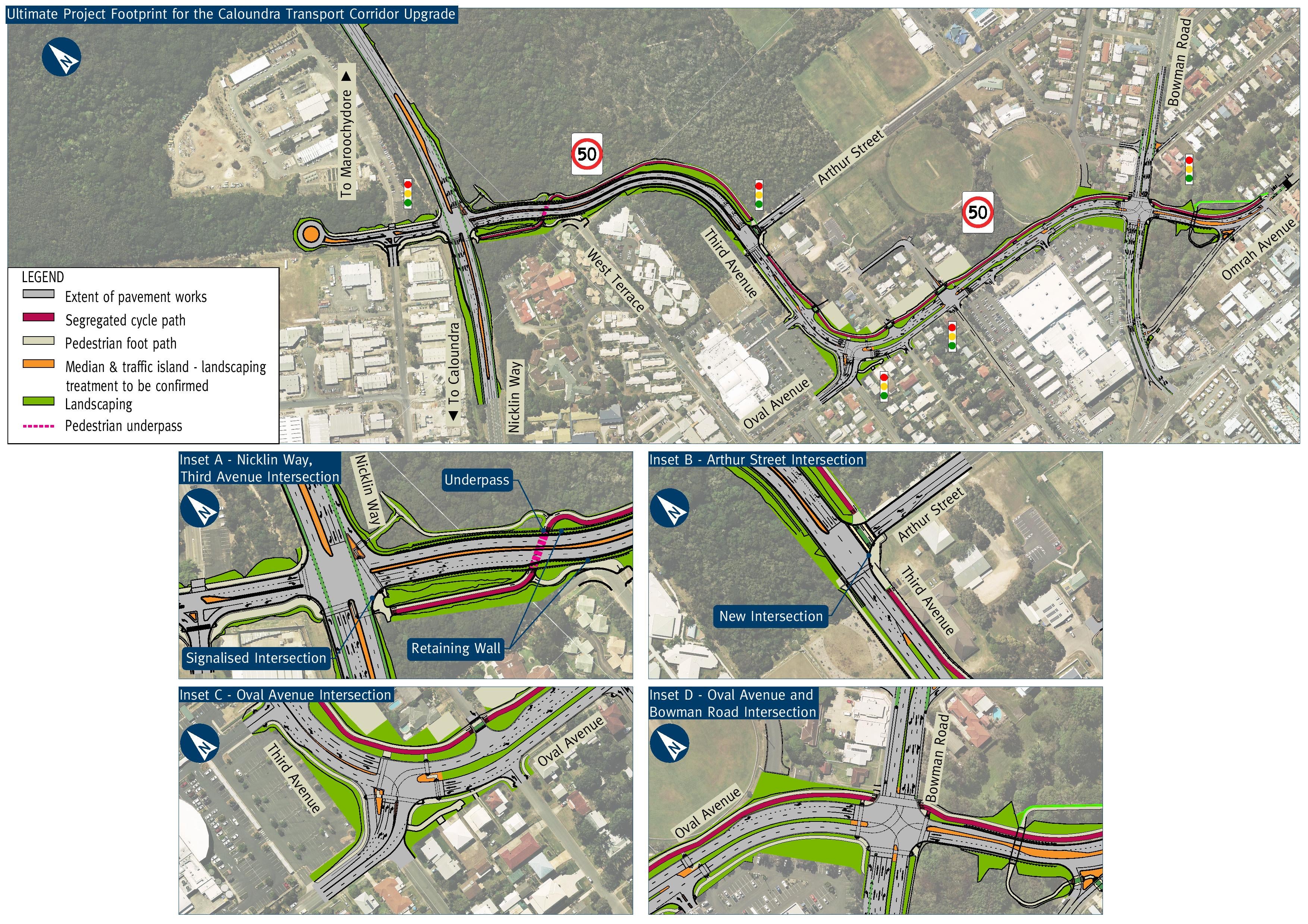
The project footprint includes a new intersection with Nicklin Way by extending Third Avenue.
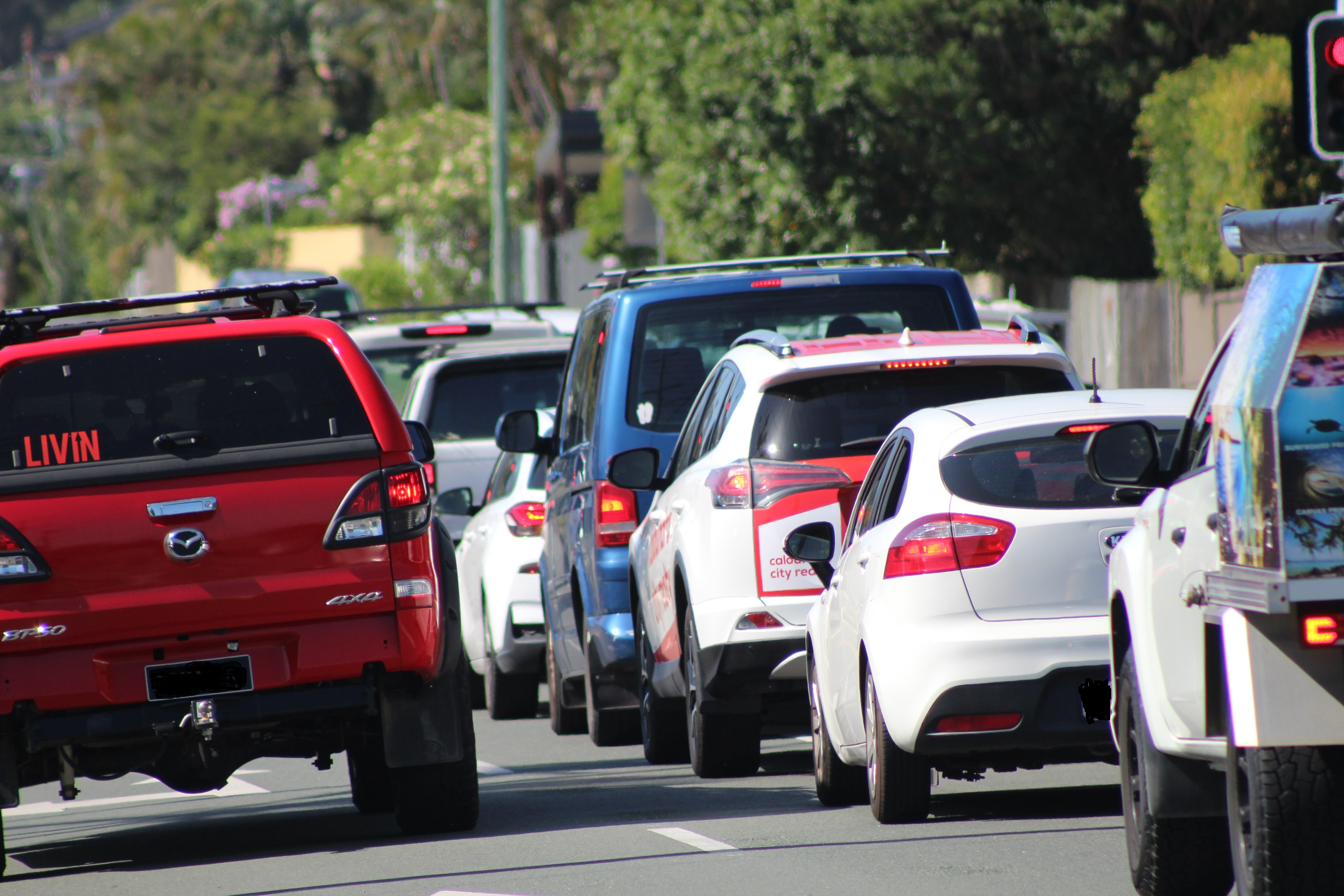
It will reduce congestion and delays at the Caloundra Road, Nicklin Way and Pelican Waters Boulevard intersection and have flow-on benefits for local roads in Currimundi, Dicky Beach and Moffat Beach.
The design also focuses on vastly improving safety and accessibility for pedestrian and cyclists with new signalised crossings, pedestrian pathways and a dedicated two-way cycle track alongside a low-speed traffic environment.
Extensive community feedback has informed the ultimate design. In response to concerns raised during the initial CTCU planning, TMR and Council established a Stakeholder Interest Group (SIG).
Since late 2022, the SIG has helped represent the interests of the local Caloundra community and has provided valuable feedback to help shape features of the design for the CTCU ultimate project footprint.
Key features the group has influenced include:
- the importance of continued connectivity between Ben Bennett Bushland Park and neighbouring properties including aged care facilities on West Terrace
- the need to reduce the impact on vegetation in Ben Bennett Bushland Park and Bicentennial Park
- the opportunity to provide accessible, safe and efficient active transport connections for bike riders and pedestrians to cater for all ages and abilities.

SIG input has directly shaped safer and more convenient access to Ben Bennett Bushland Park for Caloundra residents through the inclusion of an active transport underpass near West Terrace.
The SIG has also directly influenced a reduction to the project’s impact on Ben Bennett Bushland Park. This has been achieved with the inclusion of retaining walls on part of the new road between Nicklin Way and Third Avenue.
The SIG has made a significant contribution to help identify opportunities and concerns regarding Bicentennial Park. The overall four-lane corridor width was reduced during the design process to ensure the park and much-loved fig tree were retained.
The new intersection and road corridor is designed to meet the forecast traffic demand at opening in 2025/26 and over the next 10 years, to cater for our growing population, business and tourism.
Section One early works, including underground service relocations and property demolition, are expected to start later this year.
The final configuration of both intersections for Section Two and active transport pathway locations will be confirmed with a final design and construction details scheduled for release later this year (2023).
Delivery of the fourth leg into Industrial Avenue will be subject to available funding once detailed costing is complete.
While the four-lane footprint is now decided, the project team will continue to work closely with the SIG with further meetings this year to determine other opportunities for the project including community activation and landscaping.

Sunshine Coast Council Division 2 Councillor Terry Landsberg said the RACQ has recently named Caloundra Road the fourth worst congested road in South East Queensland.
“This upgrade will help to ease traffic congestion, reduce travel time and improve access to active and public transport in Caloundra now and into the future," Cr Landsberg said.
"I thank the SIG for helping refine the section between West Terrace and Omrah Avenue.
“Council, alongside the SIG, understands the importance Bicentennial Park plays within our community and the corridor width has been reduced through the park and new link between Bowman Road and Omrah Avenue.
“The project team has also achieved further reductions to the land required at Caloundra RSL to ensure the RAAF Helicopter and the two Bofors guns are not disturbed, as well as significant reductions to the land required in the Memorial Garden.
"With the corridor footprint now finalised, tweaks to the design will continue as well as further SIG meetings.
“The project team will continue to keep our community updated throughout construction.”

Minister for Transport and Main Roads the Honourable Mark Bailey MP said SIG members have been proud advocates for their community.
"The members have provided valuable input to help shape the look of the new intersection and road corridor between Nicklin Way and Arthur Street," Mr Bailey said.
"Knowing more about how locals use the existing spaces, such as Ben Bennett Bushland Park, will help to deliver the best possible outcomes to improve the connectivity of Caloundra's CBD.
"The project team will continue to mitigate impacts in Ben Bennett Bushland Park as detailed design continues to progress. Where impacts cannot be mitigated, an offset will be provided.
"We will be back out to the community later this year with a final design layout."
Stakeholder Interest Group member Angus Booker said he was very impressed with how the teams at TMR and SCC have come together.
"Both TMR and SCC worked to digest a wide range of community opinions for a design that balances protection of the local environment and improves access to Caloundra for both residents and visitors," Mr Booker said.
"While other transport platforms are still years off, this project is a critical piece of infrastructure for Caloundra and the Sunshine Coast for now and into the future."
Fast facts:
CTCU is a joint project with TMR responsible for the Nicklin Way, Third Avenue extension and Sunshine Coast Council responsible for the remainder of the corridor.
The project is the next step to address significant congestion experienced at the nearby intersection of Nicklin Way, Pelican Waters Boulevard and Caloundra Road, providing an alternative access to everything Caloundra has to offer.
For more information and to register to receive project updates, visit www.sunshinecoast.qld.gov.au/CTCU or www.tmr.qld.gov.au/projects/nicklin-way-third-avenue-extension-intersection.
