North Shelly Beach pilot project
This project is an outcome of the Shelly Beach to Moffat Beach coastal study.
Feedback from our community, and industry and government experts informed these outcomes.
The study’s findings are available at Have your say. There is a summary in the table below.
Please subscribe to updates on this project to receive timely information about any developments.
Project scope
The goal is to enhance what our community loves about the area and make some changes to improve conditions for turtles nesting on the beach.
To do this, we have used a best practice approach that incorporates advice from the technical experts at the Queensland Department of Environment and Science and the Queensland Herbarium for turtles, dune, and vegetation restoration.
It involved restoring the dunes to a condition that provides the best opportunity for turtle nesting success and better represents the group of plants you could expect to find in this dunal environment.
This pilot project is a trial and if successful it could be rolled out to other areas of Shelly Beach foreshore.
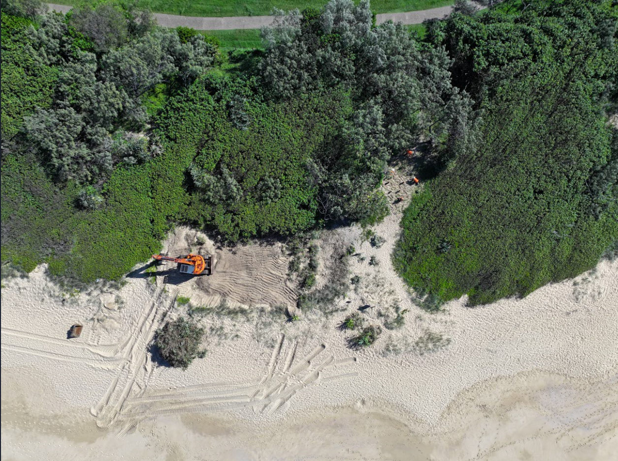
Work on the pilot project took place outside of turtle nesting season in May 2024.
What the project involved
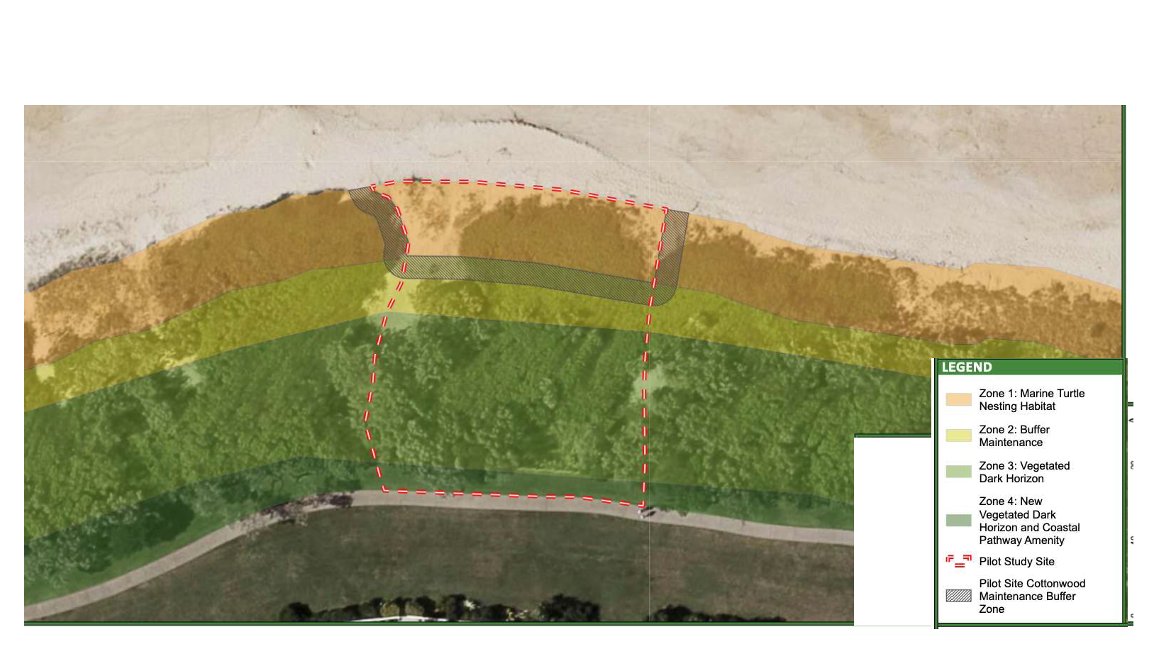
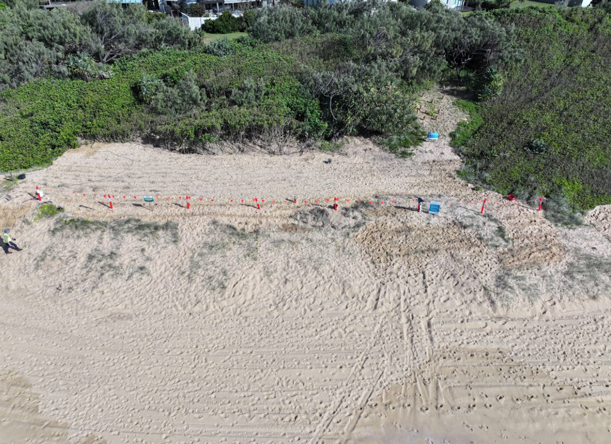
The red line on the map (PDF, 143.77KB) shows the pilot study area. Work only occurred in the orange and light green zones closest to the ocean.
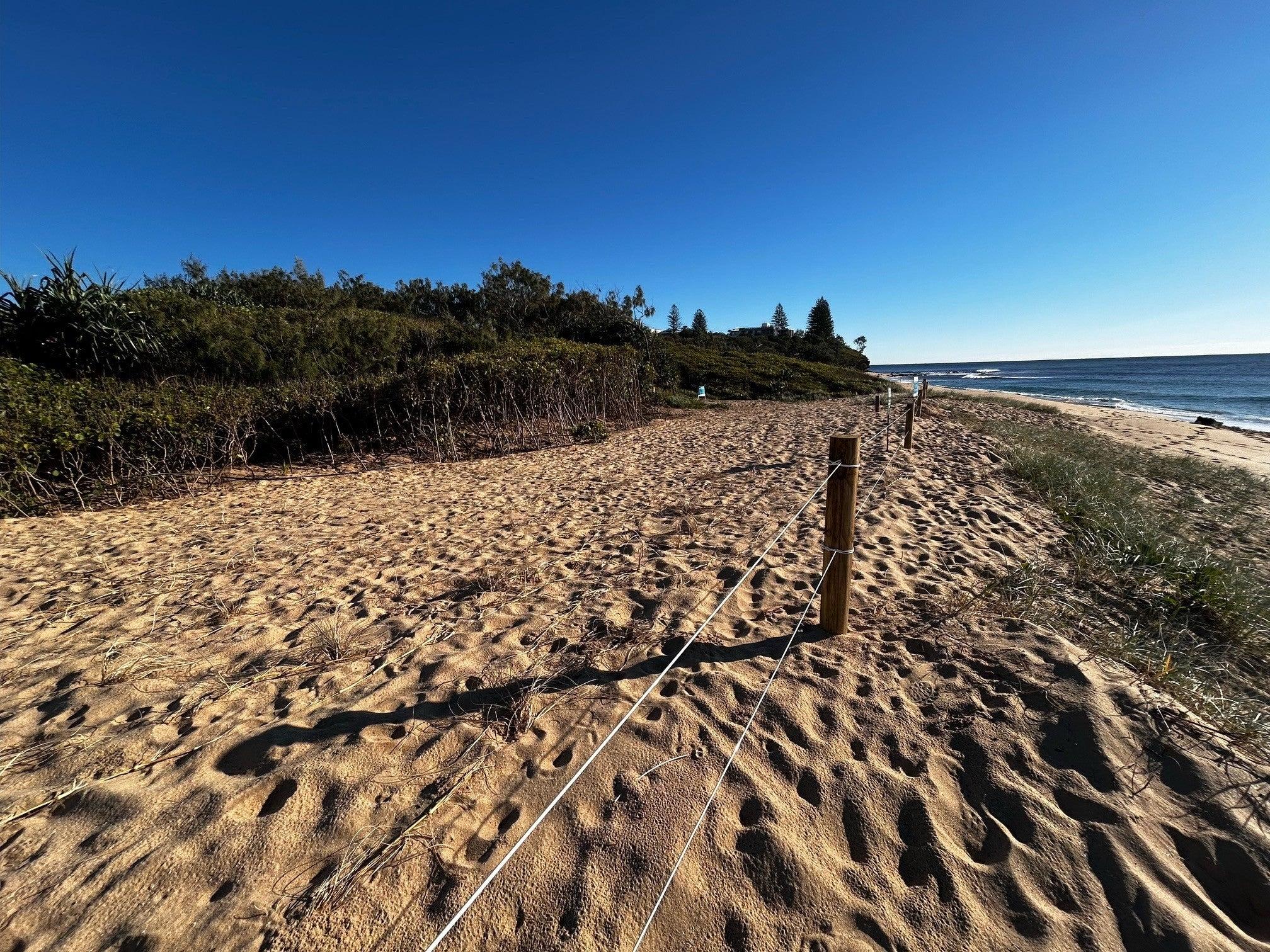
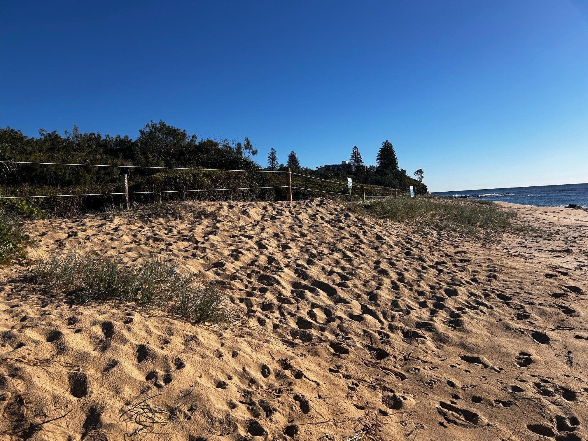
The informal beach access between Beach Access 277 and 278 was closed 1 May 2024 to help restore the dunes.
Zone 1 - Marine turtle nesting habitat
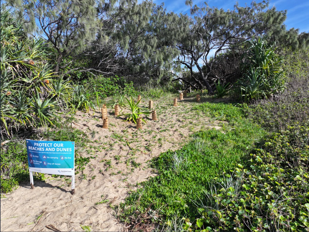
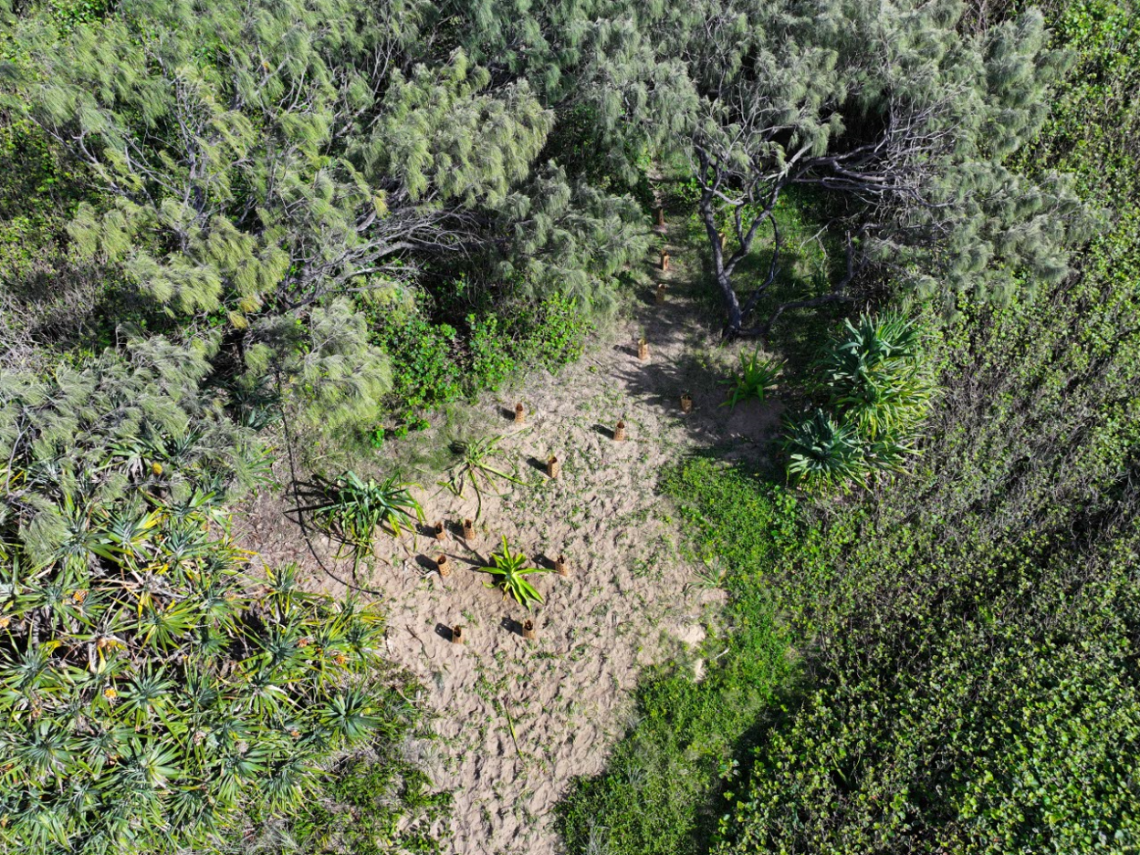
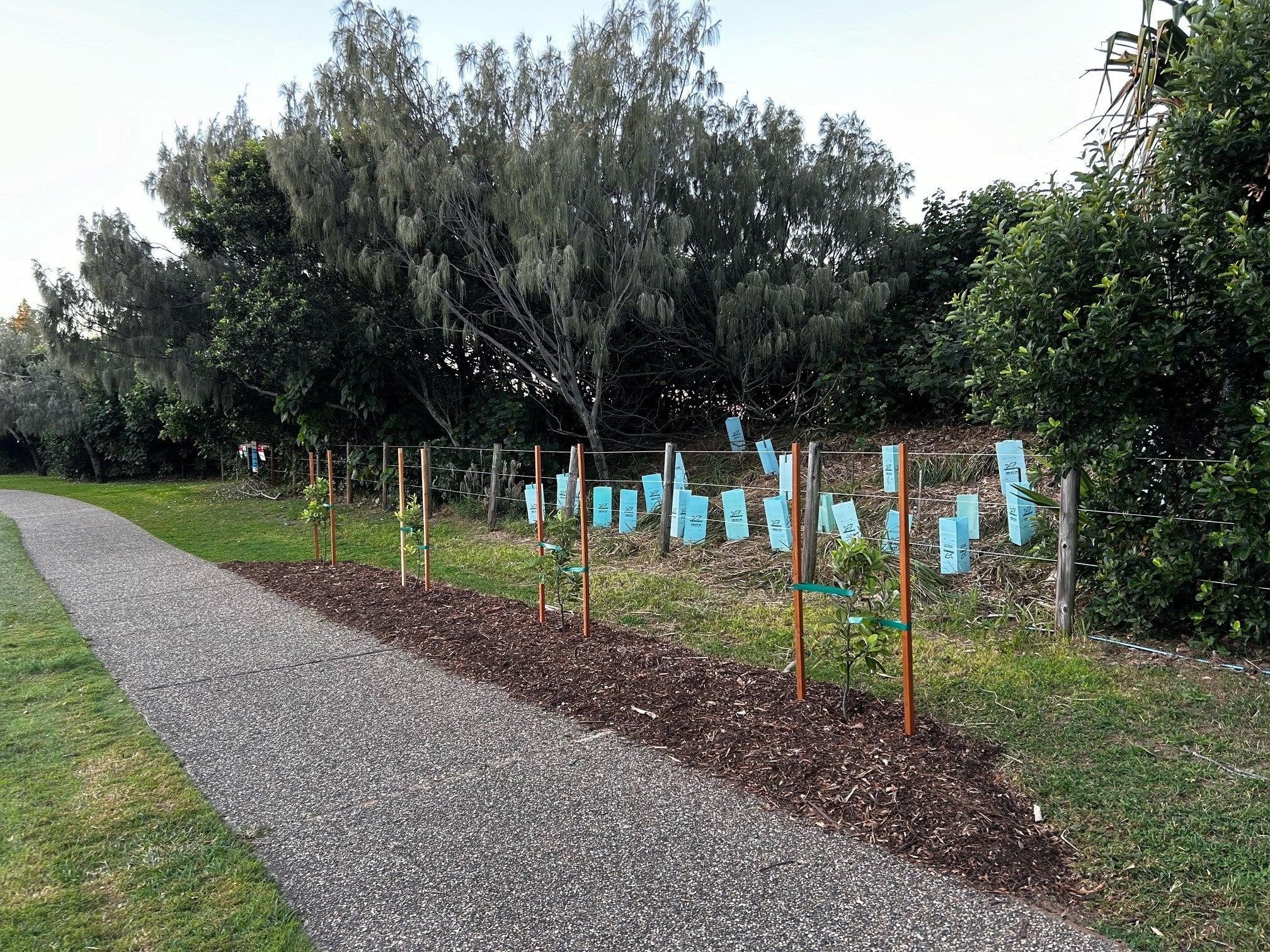
In zone 1, we removed the cottonwood trees using machinery from the front 10 metres of the dune, reprofiled the dune and then replaced the cottonwoods with native grasses, vines, sparse shrubs, and trees that have shallow root systems. This is so the roots and trees don’t get in the way when turtles are digging a nest. It will also create a more inviting and accessible space for turtles to nests.
Only plant species that are expected to naturally occur in this area were used, including spinifex and beach bean.
We also extended the temporary beach fencing at the front of the pilot study area to help protect the dunes.


Zone 2 - Buffer maintenance
In zone 2, we created a buffer around the turtle nesting habitat to stop cottonwoods moving into zone 1 and impacting the available space for turtle nesting.
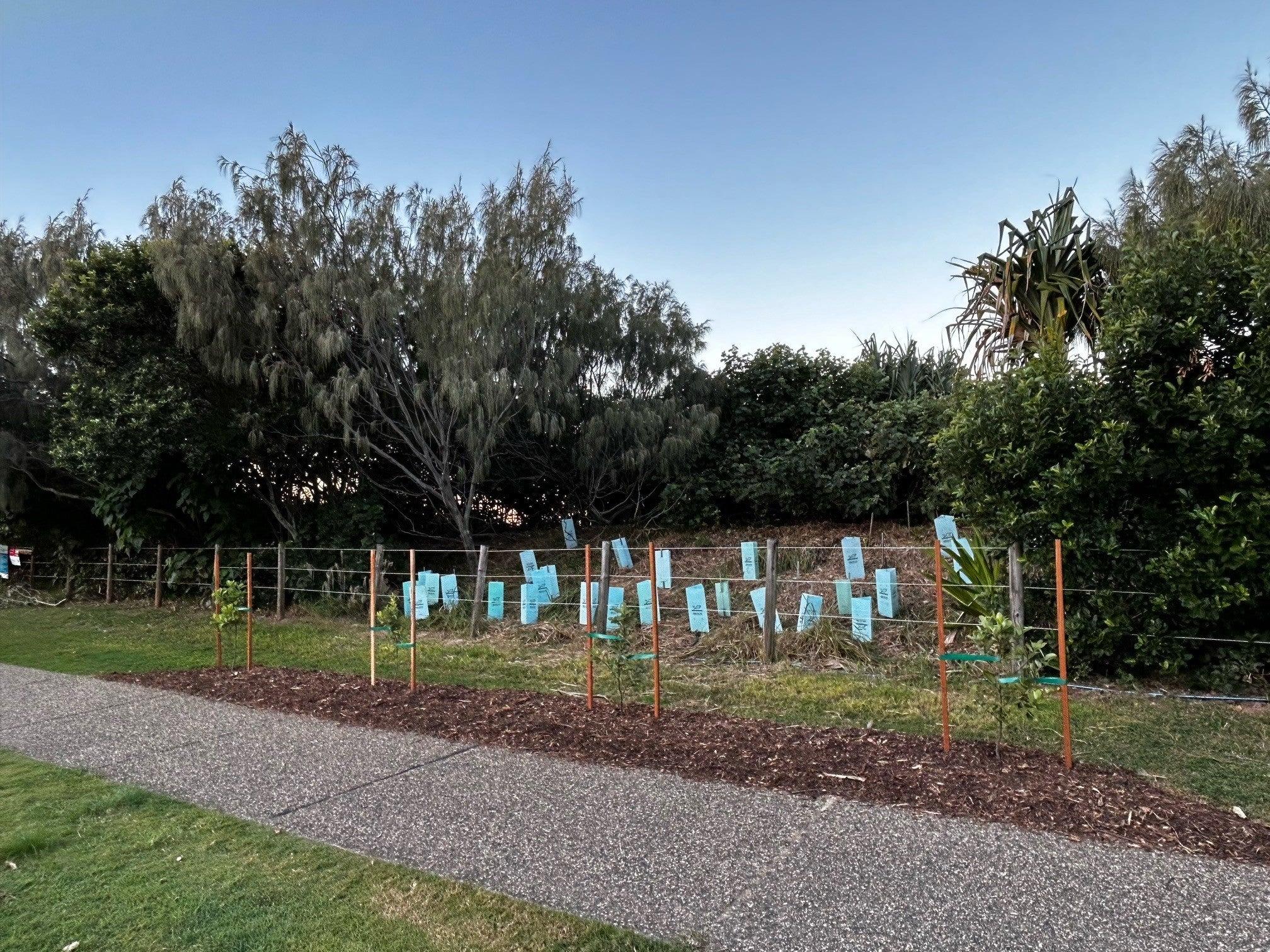
We will continue to manage the cottonwoods in this area through scheduled maintenance, pruning along the buffer zone and trimming branches (lift pruning) around young native trees to help them grow and increase the diversity of plants in the dunes. Grasses, shrubs, and trees suitable for nesting turtles were planted in this zone to gradually replace the cottonwoods.
We also worked to make the beach darker so turtles and hatchlings can find their way to the ocean. Unofficial beach accesses and tracks create gaps in vegetation and mean more light makes its way to the beach.
We planted trees to fill these gaps and block the light so it’s better for turtle sea-finding behaviour (read more below about why light pollution is a problem for turtles).
Plant species that are most likely to naturally occur in this area were used including:
- casuarina
- banksia
- pandanus
- acacia, and
- alectryon.


Zone 3 - Vegetated dark horizon
In zone 3, we did not remove any vegetation.
We worked to make the beach darker so turtles and hatchlings can find their way to the ocean. Unofficial beach accesses and tracks create gaps in vegetation and mean more light makes its way to the beach.
We planted trees to fill these gaps and block the light so it’s better for turtle sea-finding behaviour (read more below about why light pollution is a problem for turtles).
No additional cottonwood trees were planted in this zone. Plant species that are most likely to naturally occur in this area were used including:
- casuarina
- banksia
- pandanus
- tuckeroo, and
- alectryon.
Zone 4 - New vegetated dark horizon and coastal pathway amenity
In zone 4, like zone 2 and 3, we made changes to the plants to support turtle sea-finding behaviour.
We planted individual trees along the coastal pathway that are aesthetically pleasing and contribute to the overall enjoyment of our community.
These trees will also assist to fill gaps in the dunal vegetation by further consolidating the vegetated dark horizon and supporting turtle sea-finding behaviour.
Next steps
For the next 18 months, Council will take care of the site with regular maintenance.
We will also monitor the area through surveys and inspections to document the changes.
This data and information will inform future management of Shelly Beach and enable Council to determine if the project has been successful in creating suitable turtle nesting area.
Thank you for your support of the project and we look forward to sharing the outcomes in the future.
Background
Why it’s important to get the balance right between turtles and trees on the dunes
Turtles
The number of loggerhead turtle species nesting along the Queensland coastline; including Sunshine Coast beaches, has reduced significantly since the 1970s to the point that they are now critically endangered.
With only one in 1000 turtle hatchlings surviving to adulthood, every nest and every egg is critical to the ongoing survival and recovery of this critically endangered population.
Buddina and Shelly beaches typically record more turtle nests than any other Sunshine Coast beach.
In fact, Shelly Beach has been identified by Queensland Government as the index beach for the entire Sunshine Coast rookery. It was first studied in the 1970s and has been studied annually since 2005.
The proposed actions will help to make this beach more inviting and safer for turtles to nest on. There will also be more area to relocate turtle nests in the event of large tides or extreme weather. All TurtleCare activities are done under Queensland Turtle Conservation Project permits.
Trees
In the early 1960s, when Shelly Beach was mined for shell grit, the dunes were destroyed, and all the original vegetation removed.
Over time, after successive cyclones in the mid-1970s, attempts were made to rebuild the dunes by reshaping the sand and planting vegetation to hold the dunes together> This included some cottonwood trees.
While it’s appropriate for a few cottonwood trees to grow in these dunes, the trees have spread and now cover an unusually large area across the dunal system - upsetting the natural balance between plants and turtles. It is predicted that without human intervention, the cottonwoods will continue to cover much of the foredune area for the foreseeable future.
Light pollution
Light pollution is a problem for marine turtles for several reasons:
- Disorientation: Marine turtle hatchlings rely on natural dark sky cues to locate the ocean. Bright artificial light near nesting beaches, and sky glow (caused by lighting within 82km of the coastline) can disorientate hatchlings, leading them away from the sea and toward inland areas and roads. This disorientation increases their vulnerability to predators, exhaustion, dehydration, and ultimately decreases their chances of survival.
- Nesting disturbances: Female marine turtles return to the beach at night time to lay their eggs. Artificial lighting along the coast can deter nesting turtles from coming ashore or cause them to abandon nesting attempts. This disruption can significantly reduce the number of successful nests, negatively impacting the population.
Approvals
EPBC referral - COMPLETE
An EPBC referral to the Department of Climate Change, Energy, the Environment and Water (DCCEEW) was required before any of this work can take place.
The referral identified and assessed the environmental values and impacts prescribed as Matters of National Environmental Significance (MNES) under the Environment Protection and Biodiversity Conservation Act 1999 (the EPBC Act).
The referral is now complete, with the DCCEEW handing down their decision that the project is “not controlled action if taken in a particular manner”. View the decision notice.
The "Particular Manner" refers to measures council must abide by to avoid significant impacts to the threatened species and communities, and migratory species listed in the referral.
We will now consider how these measures affect the project delivery timeline and will update our community on this soon.
To stay updated on this project please subscribe to updates.
Department of Agriculture and Fisheries (DAF) referral - COMPLETE
We have received approval for our project under the Fisheries Act. This was required as marine plants are protected under Queensland Government legislation.
Community engagement
An in-depth analysis into how the coastal strip from Shelly Beach to Moffat Beach will be managed in the future was completed in April 2023.
It included expert technical advice and extensive community input to inform the study outcomes.
The study’s findings are available at Have your say, and a summary is provided in the table below.
| Key issue | Summary | Recognised authority | Project implications |
| Land designation | Long standing tension and difference of opinion with regards to what the land between William Street and Russell Street is to be used for and its appropriate maintenance in support of that use. |
|
|
| Dune conditions and vegetation considerations | Long standing tension and difference of opinion regarding the:
| Dunes:
Vegetation:
| Dunes:
Vegetation:
|
| Considerations for marine turtles (at Shelly Beach) | Long standing tension and differences regarding the conditions required to support nesting turtle populations:
|
|
|
Where to from here
This pilot project is one of several outcomes of the Shelly to Moffat Beach coastal study that will be delivered by council over the next 5 years.
To stay updated on this project and receive timely information about any developments, please subscribe to updates.
Safety at Moffat Beach Headland
This project will be aimed at improving community safety at Moffat Headland after a geotechnical expert identified a risk to people using the area. The report suggested that adding more safety fencing in some areas was one way to address this.
Council is aware of the community's concerns about fencing at this location.
Before any changes are made, the community will be asked for input as we work to find appropriate solutions that will preserve the beautiful headland while addressing the risk to public safety.
Realign the William St car park
Based on the outcomes of the study, council is considering realigning the William Street car park. Before any changes are made, the community will be asked for input.
Trail signage on George Watson park
Based on the outcomes of the study, council is considering more trail marking in George Watson park. Before any changes are made, the community will be asked for input.